
Explore Our Services
No matter the industry or project size, we're ready to talk. Reach out and hear back within 24 hours.

What We Offer
We offer a range of services to meet the needs of every client. Have something else in mind? We'd be happy to work with you to meet your needs.
-
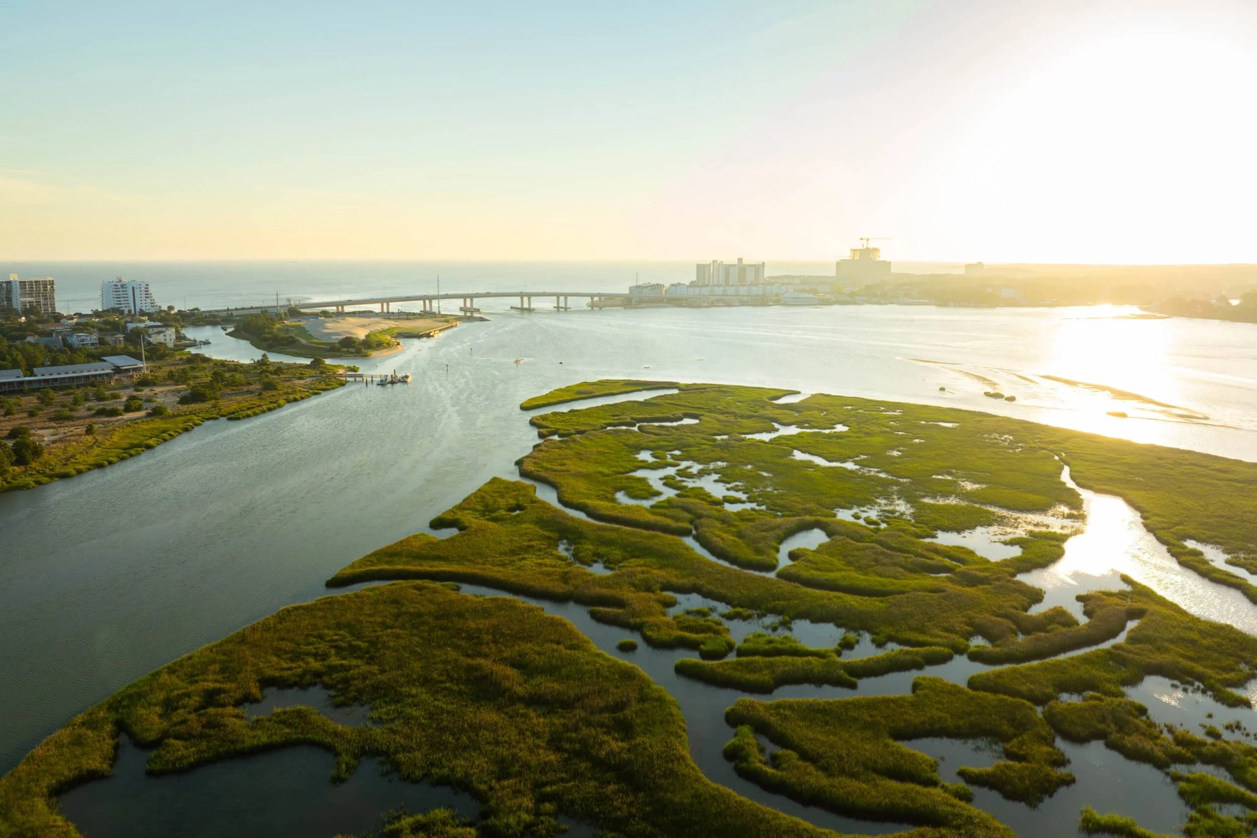
Accurate environmental data is the foundation of sound land management, regulatory compliance, and conservation planning. Envol Dynamics provides professional aerial survey services that give agencies, consultants, and landowners the spatial data they need to make informed decisions, delivered as finished GIS outputs, not raw imagery.
What We Offer
Wetlands Delineation and Mapping — Precise aerial capture and GIS analysis to identify and document wetland boundaries for permitting, mitigation, and regulatory compliance.
Watershed and Riparian Surveys — Comprehensive mapping of drainage networks, erosion patterns, and riparian corridor health to support water resource planning and restoration projects.
Post-Fire Assessment — Rapid deployment following wildfire events to document burn severity, canopy loss, erosion risk, and reforestation progress. Ideal for USFS, BLM, and state forestry agencies managing recovery operations.
Vegetation and Habitat Monitoring — Multispectral analysis to assess vegetation health, identify invasive species encroachment, and track habitat change over time.
Erosion and Land Disturbance Monitoring — Ongoing aerial documentation of disturbed sites, grading operations, and stormwater compliance for construction and industrial clients.
Range and Grazing Land Assessment — Aerial analysis of rangeland condition, forage coverage, and soil exposure to support grazing management and conservation planning.
-
Modern agriculture demands more than ground-level observation. Envol Dynamics delivers precision aerial analysis that gives farmers, agronomists, and land managers a complete picture of crop health, soil conditions, and irrigation performance across entire fields in a single flight. Every engagement ends with actionable data you can take directly to your operation.
What We Offer
Multispectral Crop Health Mapping — We capture and process NDVI and other vegetation indices to identify stressed areas, nutrient deficiencies, and disease pressure before they become visible to the naked eye. Delivered as georeferenced maps your agronomist can act on immediately.
Irrigation Efficiency Analysis — Aerial thermal and multispectral imaging identifies underperforming irrigation zones, dry spots, and coverage gaps across pivot, drip, and flood irrigated fields. Helps optimize water usage and reduce input costs.
Crop Damage Documentation — Rapid aerial documentation of hail, flood, wind, or pest damage for crop insurance claims. We provide precise acreage calculations and georeferenced imagery that meets insurance adjuster standards.
Viticulture and Vineyard Monitoring — Canopy density mapping, vine stress detection, and water status analysis for vineyard operators. Identifies block-level variability so you can target inputs precisely rather than treating the entire vineyard uniformly.
Turf Health Assessment — Multispectral analysis for golf courses, sports fields, and commercial turf operations. Identifies stressed turf, irrigation inefficiency, and disease pressure across large areas efficiently and non-invasively.
Livestock Monitoring — Locate animals across large acreage, identify sick or downed livestock, find mother-offspring pairs, assess herd health, and monitor seasonal grazing patterns. Thermal imaging allows us to locate animals quickly and efficiently across terrain that would take ground crews hours to cover on foot.
-
Energy infrastructure fails quietly. Whether it is a faulty solar panel, an overheating transformer, or a crack developing on a turbine blade, the earliest signs of failure are invisible to the naked eye and often undetectable from the ground. Envol Dynamics uses thermal and RGB aerial imaging to find what ground crews miss, delivering professional inspection reports that asset managers, O&M teams, and utility operators can act on immediately.
What We Offer
Thermal Hotspot Detection — We use radiometric thermal cameras to identify individual panel anomalies including hotspots, bypass diode failures, and cell-level defects that are invisible to the naked eye. Every anomaly is documented with GPS coordinates, thermal imagery, and defect classification.
Full Array Inspection — Systematic aerial coverage of entire solar installations from small commercial rooftop systems to large utility-scale ground mount arrays. We capture both thermal and RGB imagery in a single mobilization giving O&M teams a complete picture of array condition.
Defect Classification and Reporting — Every inspection is followed by a professional report that classifies defects by severity, documents their location within the array, and prioritizes remediation. Reports are formatted for O&M workflows and asset manager review.
Recurring O&M Inspection Programs — We work with asset managers and O&M firms to establish recurring inspection schedules that track array health over time, catch emerging issues early, and document performance trends across inspection cycles.
Substation and Electrical Infrastructure Inspection — Thermal inspection of transformers, switchgear, and electrical panels at substations and utility facilities. Overheating electrical components are a leading cause of equipment failure and unplanned outages. Aerial thermal imaging identifies failing components before they become costly problems.
Wind Turbine Inspection — Thermal and RGB inspection of turbine blades for surface cracks, erosion, and structural defects. Drone inspection eliminates the need for rope access teams and dramatically reduces inspection time across multi-turbine installations. A growing market across the Mountain West and Pacific Northwest where wind development continues to expand.
-
Construction projects move fast and mistakes are expensive. Aerial data gives project managers, engineers, and owners a real-time view of site conditions, progress, and potential issues before they become costly problems. Envol Dynamics provides professional aerial documentation and inspection services across the full project lifecycle from groundbreaking through final walkthrough.
What We Offer
Infrastructure and Bridge Inspection — Aerial inspection of bridges, retaining walls, culverts, and other infrastructure assets. Close-range RGB and thermal imaging identifies surface cracking, spalling, water infiltration, and structural anomalies that ground-level inspection misses. Federal and state transportation departments inspect bridges on a mandatory two-year cycle creating consistent recurring demand for qualified aerial inspection operators.
Volume and Stockpile Calculations — Precise aerial photogrammetry to calculate earthwork volumes, stockpile quantities, and cut-and-fill balances. Faster and more accurate than traditional ground survey methods and repeatable across the project timeline to track material movement.
Site Mapping and Topographic Survey — Pre-construction aerial mapping and topographic modeling to support site planning, drainage design, and engineering. Delivered as georeferenced orthomosaics and digital elevation models compatible with standard CAD and GIS software.
Progress Monitoring — Regular aerial documentation of active construction sites at weekly, biweekly, or monthly intervals. Timestamped imagery and orthomosaics create a visual record of site progress that keeps owners, lenders, and project managers informed without requiring site visits.
-
Envol Dynamics is an SDVOSB-certified, SAM.gov registered drone services company built specifically to operate in the federal contracting space. We fly NDAA-compliant equipment, understand federal reporting standards, and hold statutory priority on set-aside contracts across our service verticals. As veteran founders we bring a level of credibility and trust with federal clients that civilian operators cannot match.
What We Offer
Federal Land Surveys — Aerial mapping, monitoring, and environmental survey services for BLM, USFS, and National Park Service land management programs. We provide georeferenced orthomosaics, vegetation analysis, erosion monitoring, and habitat assessments across federal land holdings in the Mountain West.
Federal Facility Inspection — Aerial inspection and documentation of VA medical centers, GSA-managed federal buildings, and other agency-owned facilities. Roof condition assessment, grounds mapping, infrastructure documentation, and facility condition reporting.
Federal Construction Monitoring — Aerial documentation services for federally funded construction projects. Progress monitoring, volume calculations, and site mapping delivered on a recurring schedule throughout the project lifecycle. We provide the aerial documentation layer that keeps federal projects properly documented and on track.
Army Corps of Engineers Environmental Surveys — Wetlands delineation, waterway mapping, and environmental monitoring in support of Army Corps civil works and regulatory programs. We understand the reporting standards and deliverable formats the Corps requires and produce outputs that hold up to agency review.
USDA Agricultural Programs — Aerial crop health mapping, damage documentation, and land condition surveys in support of USDA Farm Service Agency and Natural Resources Conservation Service programs. We work directly with FSA and NRCS field offices to provide the aerial data that supports farm program administration, conservation planning, and crop insurance verification.
UXO Detection and Site Support — We conduct aerial magnetometry surveys over suspected UXO sites to identify subsurface anomalies and produce georeferenced reports that support remediation planning and ground team operations. This service is available to Army Corps of Engineers Formerly Used Defense Sites programs, state environmental agencies, and DoD remediation contractors.
Our Process
Scope & Plan
Every project starts with a conversation. We learn what you need, assess the site, and build a flight plan tailored to your specific deliverable requirements.

Deploy to Site
Our team deploys to your site with the right equipment for the job, thermal, multispectral, or RGB, and executes the mission efficiently with minimal disruption to your operations.
Process the Data
Raw data means nothing without interpretation. Our GIS specialists process every capture into clean, accurate outputs including orthomosaics, thermal maps, defect reports, or whatever your project requires.
Deliver Results
You receive a finished, professional deliverable, not a hard drive full of raw files. We walk you through the findings and stay available for follow-up questions.