
Precision aerial intelligence, built to support any mission.

Envol Dynamics delivers precision drone services across a variety of verticals
FAA
Part 107 Certified Operators
Service-Disabled Veteran-Owned Small Business (SDVOSB)
SAM.gov Registered — Federal Contracting Eligible
RGB & Thermal Sensor Operations
-
![A clear stream flowing through a lush green valley with pine trees and mountain peaks in the background under a blue sky with some clouds.]()
Environmental & Land Surveys
From wetlands delineation to post-fire reforestation tracking, we deliver the aerial data federal agencies and environmental consultants need to make informed land management decisions.
-
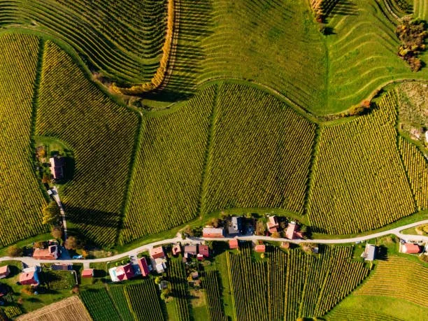
![Aerial view of green vineyards and small houses along a winding road.]()
Agricultural & Crop Analysis
We help farmers, vineyard operators, and course superintendents see what ground-level inspection misses. Multispectral imaging and NDVI analysis identifies crop stress, irrigation inefficiency, and disease early
-
![]()
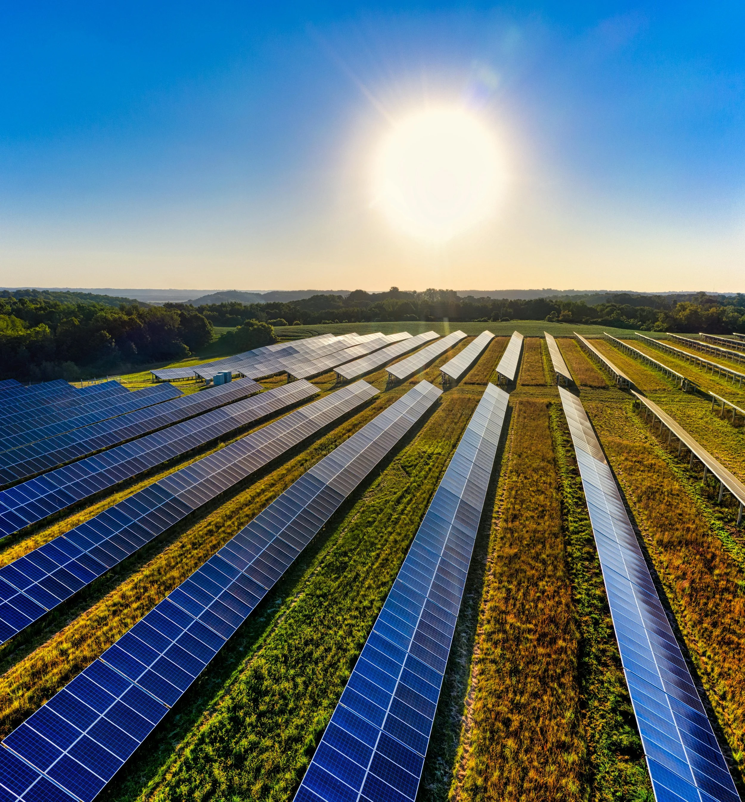
Solar & Energy Inspection
Regular thermal inspection is the most effective way to protect the performance and lifespan of a solar investment. We identify hotspots, defective panels, and string failures that are invisible to the naked eye.
-
![Aerial view of a construction site showing multiple wooden structures in different stages of building, construction vehicles, and equipment, with a parking lot and dirt areas surrounding the site.]()
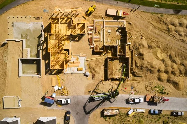
Construction & Development
From breaking ground to final walkthrough, we document every stage of your project with precision aerial imagery. Whether you need progress monitoring on an active build or aerial inspection of a residential or commercial property, we deliver finished work that's ready to use.
-
![Rusty, abandoned bombs lying on dirt ground.]()
Government Contracting
As an SDVOSB-certified company we hold statutory priority on federal set-aside contracts across environmental, surveying, and inspection verticals.


Data is just
the beginning.
Collecting aerial data is only half the mission. Envol delivers full-service geospatial, environmental, and remediation reports that transform raw sensor data into actionable intelligence — the kind of deliverable you can hand to a regulator, a federal agency, or a board.
Our team combines drone operations with GIS analysis, remote sensing interpretation, and field expertise to produce professional reports that meet scientific and regulatory standards. No third-party analyst needed. No data hand-off. Just a complete, defensible product from collection to conclusion.
-
Mapped spatial analysis, change detection, habitat classification, and land cover assessments delivered as formal GIS reports with supporting data products.
-
Site assessments, wetland delineations, watershed analyses, and habitat surveys written to scientific standards for regulatory submission or research publication.
-
Thermal inspection findings, infrastructure condition assessments, crop health analysis, volume calculations, and site documentation delivered as professional client-ready reports across all Envol service verticals.
Let’s Work Together
We go where the work is. Whether you need a one-time survey or an ongoing inspection contract, reach out and we will scope it out and get back to you fast.